View Bukit Timah trek to Buona Vista - rail corridor in a larger map
After years of negotiation,
the Singapore government has finally taken over the more than 25km strip of land which links Singapore’s south at Tanjong Pagar Station
to Woodlands that was Malaysia’s in a historic land swap.
It has been more than a year
since this rail corridor has been stripped of its sleepers. After the initial excitement where almost
everyone has descended on this corridor to walk, take photos and bike, the
former railway is finally undergoing a recuperation period. Grass has grown on the
parts where sleepers previously laid and vegetation has encroached into the space where trains used to run. Had it not been for NEA’s maintenance, there would not have been any trace of the former railway tracks.
Starting from Bukit Timah :
We chose a weekday to check out the rail corridor in order to avoid the bikers and joggers who were constantly jostling for space with each other. From home, it was a kilometer walk to our starting point at Bukit Timah Nature Reserve at Hindhede Road. Hubs and I half crawled and climbed up the steep slope that led to the railway behind The Mondrian, clutching on tufts of overgrown grass.
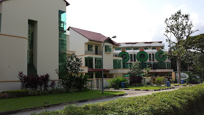 |
| We spied condos at the beginning of our trek. This point provides a chicken out if the going gets tough. |
 |
| This sandy part was where the railway formerly ran |
It was not the best spot to
start our trek because there was no obvious trail or clearing leading to the tracks. A better access point
would be the other side of the railway bridge but this we only
discovered at a second trekking session a week later.
Tall grass obscured the
sounds and sights from Bukit Timah Road once we were on the former track. The black rail bridge is only the width of
Hindhede Road below, but it is a poignant reminder that not too long ago,
trains chugged along it to Malaysia.
We turned north and walked on
the grass where ballast previously (
granite bed for sleepers ) lie. This makes walking easier without the risk of twisted ankles. Bukit Timah Road flanked our right while the boundary of the
nature reserve flanked our left. A couple of monkeys ignored us because we did not carry plastic bags which they
associate with food.
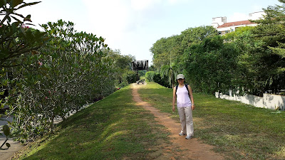 |
| Near Dunearn and Bukit Timah junction. Standing on what was previously sleepers. |
We walked on the green
corridor that ran under the PIE turnoff from Bukit Timah Road. Graffiti artists
had visited and left their indelible, artistic marks on the
concrete walls. Tyre sounds boomed above our heads and colorful graffiti on
both sides reminded me of some forgotten place in LA.
At Rifle Range Road, the trek
opened up to a clearing. It was almost road level and a pathway provided access to
the bus stop on our right. Garden Vista was just before us and it was one section
that is closest to ‘human civilization’.
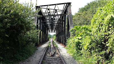 |
| Over Dunearn Road and the canal |
The rail bridge over Dunearn
Road and Bukit Timah Road was one of the longest on our trek. I like this
section because the enormity of the
black truss gives a feeling of reliability
and security. At this juncture, we traipsed carefully over the remaining sleepers, some
made of concrete and others of wood. The manufacturer’s imprint on the
fasteners connecting the track to the sleepers was still visible.
 |
| Okay , we made the first km. Time to celebrate. |
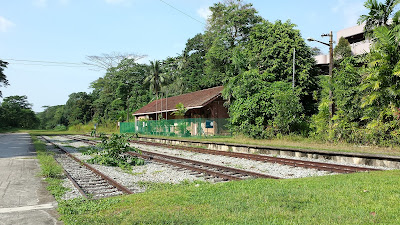 |
| Bukit Timah Signalling Station |
 |
| Now a property of SLA |
 |
| This sign must have meant a lot to different people over the past |
 |
| Sections of rails at the signaling stations are called blocks. |
At the other end of the
bridge stood the defunct Bukit Timah signalling station. This section forms the
broadest part of the corridor, apart from the terminal at Tanjong Pagar. The sounds of the city ebbed and
cries of birds took over time and space.
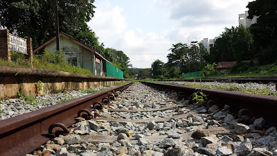 |
| You won't believe it is meters away from Clementi Road. |
We could see parts of King
Albert Lodge and The Sterling at our right and left but what caught our
attention was this ostensibly huge bungalow overlooking the rail blocks and the unused signalling house . There were
many fruiting banana trees in the clearing that got me planning my next visit so
that I can harvest the fruit.
 |
| Morning! Glory! |
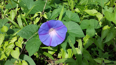
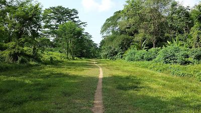
Beyond this clearing, the
landscape resumed to a narrow corridor of grass now growing over the former ballast. A patch of blue and purple morning glory
carpeted the floor, attracting butterflies and sunbirds. The last time I saw so
many morning glory was many decades ago on the fence of my primary school.
 |
| Immediately beyond Bukit Timah Signalling Station, off SIM |
 |
| Take a break! Phew! |
A lady walking her Labrador
passed us by, followed by a jogger at the stretch near SIM at Clementi Road.
Being close to nature do wonders to people and we greeted each other cheerfully.
I was particular thrilled to
walk over the Pandan Canal. For years, I would peer at the windy canal from
Clementi Road, wondering where it led beyond. This day I had my curiosity
satisfied.
 |
| Every section actually looks different, contrary to what it seems here. |
At the section of the trek
near Clementi and Pandan Road, things got a little muddy. Rivulets of water near the undergrowth streamed here and there, making walking even on a sunny day a messy affair. We were
lucky no cross country bikers were around this 5 m stretch to fight for space
with us or we would end up in a muddy mess.
 |
| There! I always wanted to snoop the 'jungle' behind Clementi Road. Now I get my wish. |
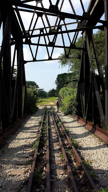
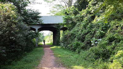
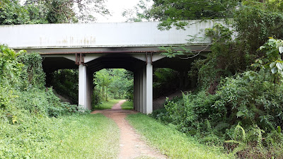
The trek led us under a
service road that serves Holland Road. It was not a pretty section because the space was only enough for the train.
Vehicular sounds became more pronounced as we walked towards Holland Road above
us. At Holland Green, a jogging path ran parallel to the trek for a couple of
meters before parting ways.
 |
| Black Truss |
 |
| Near Pandan Canal, off Clementi Rd |
 |
| Holland Rd above. We just navigated over the muddiest stretch of the walk. |
 |
| The space that could accommodate a train |
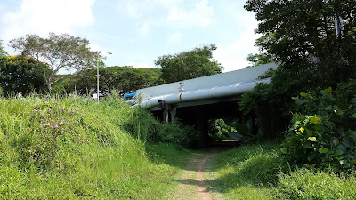
After the next underpass, we
heard the school bells of Henry Park Primary School at our right. Caltex
Station was at our left but all I could think of was Cold Storage behind the
petrol kiosk where a cold drink or popsicle would be so possible. We were still
below road level and the steep slopes pregnant with bushes made going up
impossible. Now at 11 am, I was drying up inside and out. It made admiring the
green corridor difficult.
We oohed and aahed at the
back of huge houses with lush gardens. Some pockets of backyards were
surreptitiously cordoned off as extended personal gardens in the days of the Malaysian
rail. Hmm, I wonder what the Land Tax folks think.
 |
| Nearing the main thoroughfare at Holland Road. |
At Bouna Vista Road, I
decided to call an end to our walk. The last few hundred meters after Henry Park Primary School was flanked
by high fence ( Ulu Pandan Community Center on our right and houses on our left
). I felt claustrophobic and hemmed in especially when the track is mostly below road level even though we were out in the sun and the high fences on both sides did not help either. Bouna Vista provided the first break and with hub’s help, I overcame the slope and a drain to find myself in the
middle of Bouna Vista Road facing the Civil Service College.
By then it was almost high
noon. We made our way to The Star where we rewarded ourselves with a long cool
drink and a pig-out at the hawker center.
In the 2 hours, we covered a
modest distance of about 6 km. It was an undulated walk and other than the
muddy section near Holland Park, was simply a walk in the park.